Eruption in Reykjanes - everything you need to know
Last updated December 5, 2024 – next update December 10, 2024.
Status of the eruption:
An eruption started between Stóri - Skógfell and Sýlingarfell at 23:14 Wednesday, November 20, 2024. The eruption is the seventh in a series of volcanic eruptions in the Sundhnúks crater series that began in December 2023.
- Unchanged since the last update: Eruption turbulence and activity have decreased only in the northernmost crater east of Stóra-Scógfell. Lava flows east towards Fagradalsfjall.
Civil Defense risk level:
The National Police Chief, in consultation with the police chief of Suðurnes, decided on November 22, 2024 to move from the uncertainty level to the alert level due to the eruption. The main changes in the shift in the level of risk are in the work of emergency responders and civil protection, and the decision to open/close nearby areas.
- Unchanged from the last update: As of today, we are still on the alert level.
Risk assessment:
The Icelandic Meteorological Agecy regularly updates the risk assessment during an eruption, which is used to evaluate openings and closures in the area. The risk assessment published by the Icelandic Meterological Agency on December 3rd can be found here and is valid until December 10th without any changes.
Accessibility/Availability
- Grindavik and Svartsengi were evacuated at the beginning of the eruption. Svartsengi remains closed today except for emergency responders, researchers, and those working within the area. The Blue Lagoon and Northern Lights Inn are therefore closed too.
- Grindavik is now open to public access. You can get there either via Nesvegur or Suðurstrandarvegur.
- Cracks withing Grindavik have been fenced off, but it is still important to through the area with respect and caution, by following instructions.
- Open areas in and around Grindavik have not been specifically inspected. It is therefore important that visitors stick to marked trails and streets and avoid going out into other open areas.
- Fagradalsfjall remains accessible, with all hiking trails open. However, please follow Air Quality Guidelines, as gas contamination from the ongoing eruption is possible.
- Bridge between continents, Gunnuhver, Reykjanes Lighthouse, and Brimketill remain accessible via Nesvegur.
More information regarding access to the eruption site and surrounding area:
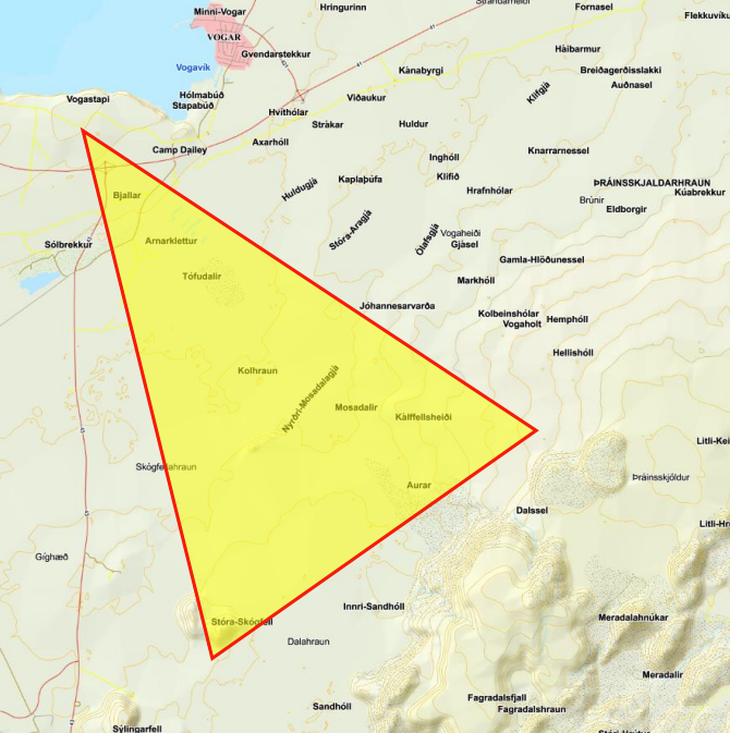
The area south of Vogar and Reykjanesbraut close to the Sundhnúksgígar eruptions is an old military training area. Bombs have been searched for in the area throughout the years and it still believed to be contaminated with both active and inactive bombs. The area has been a popular outdoor recreation area for the past few decades with locals and outdoor enthusiasts and attention is drawn to the possible threat of bombs with signs at the beginning of the hiking trails.
Now that there is increased interest in getting closer to the eruption and this particular area, it is right to draw attention to the situation and it is important to inform everyone who enters the area to stick to the marked hiking trails. It is the police chiefs recommendation that tourism operators provide information for tourists about this situation.

Key takeways
- The ongoing eruption is not accessible to tourists or locals under current conditions
- It is important to stick to marked hiking trails and paths
- Smoke and gas pollution could come from volcanic eruptions and wildfires
- Air quality near the eruptions is bad
- There are no organized parking or viewing facilities
- Drivers do not park on or around Reykjanesbraut
- A volcanic eruption is underway and conditions can change with little notice. Dangers may lurk in and outside the marked areas
Air quality and guidelines:
Those who are visiting, live or work in Reykjanes are advised to regularly check the air quality in the area on the website of the Environmental Agency here. You will also find instructions on how to react to possible bad air quality and gas pollution.
Useful links to monitor and review updates on the events:
- The Icelandic MET office: Latest information on the seismic activity and development of events. The Icelandic Meteorological Office is observing and monitoring the eruption, analyzing developments and updating on any changes in cooperation with the Department of Civil Protection and Emergency Management, and a team of scientists from the University of Iceland.
- The Icelandic Road Administration: Information on road conditions and closures in the Reykjanes region
- Safetravel: Updates on safety
- The Icelandic National Broadcasting Service: News coverage
- Visit Reykjanes: Updates on travel information in the Reykjanes region
- Iceland Ministry for Foreign Affairs: FAQ regarding flights and other info
- Live feeds from the ongoing eruption: ruv.is - mbl.is - visir.is

