Skip to content
⚠ Eruption in Reykjanes. Read updates
here
!
Close
Destinations
Nature
Reykjanes Unesco Global Geopark
Geosites
Scenic Nature
Reykjanes Nature Reserve
Top Destinations
Keilir
The Lighthouse on Gardskagi
Gunnuhver
Kleifarvatn
Reykjanes Lighthouse
Mt Thorbjorn
Brimketill
Landmarks & Historic places
Churches
Lighthouses
History and Culture
The Volcanic Way
Highlights
Towns
360° Tour of Reykjanes Peninsula
Sundhnúkagígaröð & Eldvörp - 360° Aerial Panoramas
Experiences
Activities
For the family
Sightseeing
Sightseeing and Helicopter Flights
Photo Tours
Outdoor Activities
Horse Activities
Bicycle Tours - Biking
Hiking Tours - Hiking
Cave Exploring
Golf Courses
ATV & Buggy Tours
Water Activities
Whale Watching
Sea Angling
Kayak Tours / Paddleboarding
Boat Tours
Diving & Snorkeling
Bird Watching
Culture & Heritage
Museums
Exhibitions
Cultural Centres
Crafts & Design
Saga & Heritage
Swimming and Geothermal Areas
Swimming Pools
Wellness & Spa
Volcano Tours
Hiking Trails
Yearly Events
Events
Northern Lights
Food & Accommodation
Accommodation
Hotels
Guesthouses
Bed & Breakfast
Cottages
Apartments
Hostels
Camping
Camping
Motorhome and Camper rental
Culinary experience
Restaurants
Cafés
Pubs & Clubs
Take Away
Breakfast Places
Local Food
Culinary experience - tours
Camper winter service
Nap and go
Conference and meeting rooms
Travel Info
Tours
Day Tour Provider
Northern Ligths Tour
Travel Agency
Luxury Tours
Bicycle Tours - Biking
Northern Lights Tour
Practical Information
Tourist Information Centres
Maps & Brochures
Currency
Icelandic Water
Icelandic Weather
Road Conditions in Iceland
What to Pack for the Seasons
Car charging stations
How to Get Around
Car Rentals
Public Transportation
Domestic flights
Taxi
Bicycle Rentals
To Iceland by air
Things to know about Covid-19
Visitor Centres
News
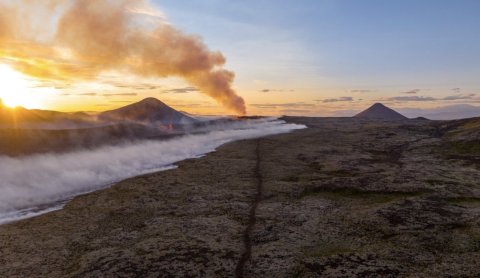
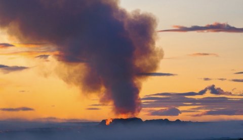
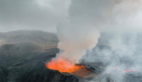
Volcano news
Eruption Information
Eruption Information
Eruption news
Eruption FAQ
Hiking and parking
360° Aerial Panoramas
The eruption sites
Webcams from the eruption site
Images
General Information
Tours to the eruption site
Grindavík municipality
Safety Information
Safety Information
Safetravel
Weather in Geldingadalir
Volcanic Gases
Drones - information
Íslenska
Eruption News
Map
My favorites
Explore other regions:
North
East
South
Reykjanes
West
Westfjords
Reykjavik
Íslenska
English
Search Reykjanes
Or try searching by Category and/or Location
Find
Everything
Accommodation
Activities
Camping
Culinary experience
Culture & Heritage
Destinations
Experiences
Food & Accommodation
General Information
How to Get Around
Landmarks & Historic places
Nature
Outdoor Activities
Practical Information
Sightseeing
Swimming and Geothermal Areas
Tours
Travel Info
Water Activities
Close to
Anywhere
Gardur
Grindavik
Reykjanesbaer
Sandgerdi
Suðurnesjabær
Vogar
Hafnir
English
/
Travel Info
/
News
/
News
News
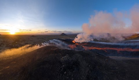
Road closures and traffic delays in Reykjanes peninsula
Visitors can expect traffic delays due to filming from 22.July (@22:00) to 23. July (@8:00)
All hiking trails open and a new hazard map published
All hiking trails from road no 427 are open today and the Icelandic MET office has published an updated hazard map.
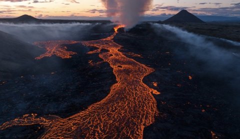
Road no. 248 open - Vigdísavallavegur
The Authorities have opened the road to Vigdísavellir again
All hiking trails open today
Updated information from the local Authorities is in the blog
Hiking trails open until 17:00 today
Information from the local Authorities is in the blog
All hiking paths open today
Information from the local Authorities is in the blog
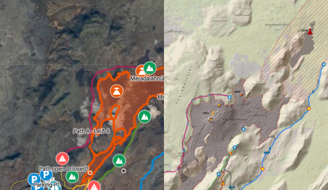
Path D is now path E - Merardalaleið
The paths have been updated after the last opening
Path E - Merardalaleið is now open
New hiking map available here.
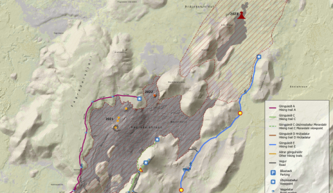
Hikingtrails closed
Reconsidered at 1 Pm
All hiking trails closed today 16th July
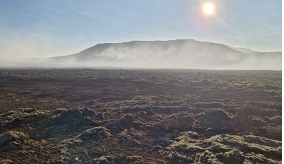
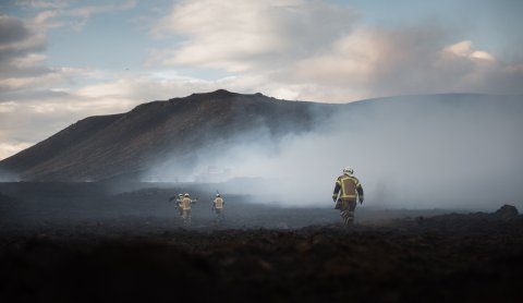
Due to smoke on the hiking trails
Hiking paths closed today
The hiking paths are closed due to smoke and bad weather conditions
All access to eruption site closed
The access to the eruption aite has been closed until 15. July.
2
3
4
5
6
7
8
9
10
11